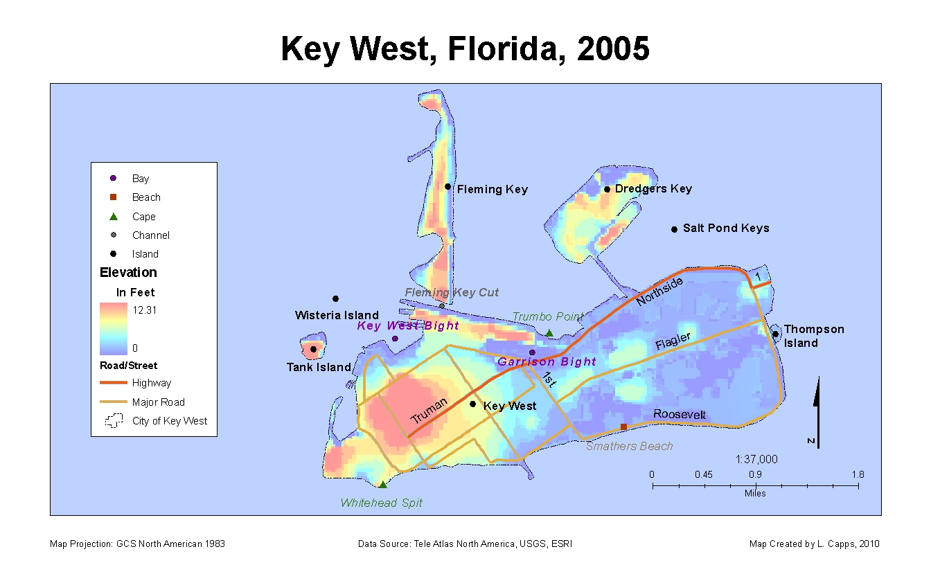
Hurricane Wilma made landfall over Key West, FL on October 19, 2005 as a Cat. 3 storm. The main damage to Key West from Wilma was not as a result of the storm itself (high winds, rain), but from the storm surge cause by the storm. Waves up to 8 feet in height inundated the islands the morning after the storm. Almost 60% of the homes on the islands were under water. The above map displays the elevation and bathymetry of Key West with Key West places and roads displayed. Notice how much of the is island is below the 8 feet elevation of the storm surge.
 The map above displays just how much of the island was flooded. The flooded land has been broken down into land types, and a graph has been created to show exactly how much of each kinds of lands were inundated (see graph below for larger image included in above map). Note that more than 68% of the flooded land was developed land (i.e. homes and businesses).
 The following is a simple graph displaying land types measured in acres and square miles affected by the storm surge.
 The map above displays just how much of the island was flooded. The flooded land has been broken down into land types, and a graph has been created to show exactly how much of each kinds of lands were inundated (see graph below for larger image included in above map). Note that more than 68% of the flooded land was developed land (i.e. homes and businesses).
Infrastructure and health facilities have been added to the following map. Notice how both hospitals have been flooded and all schools and churches except for one of each were under water. It also appears that the airport is located on one of the lowest portions of the island (see first map). With this being the case, emphasis should be focused on roads in and out of the island, since roads can be made somewhat "flood proof" by elevating them. Emphasis should also be placed on schools/churches on the highest portion of the island, since they would be the least likely to flood, or at very least, be the first to "dry out" in the case of flooding. These building could be used as staging points and/or shelters for those who chose not to evacuate.
The following is a simple graph displaying land types measured in acres and square miles affected by the storm surge. 
In closing, is appears the long-term sustainability of the island is not positive. With the highest elevation on the island being only just above 12 feet, anyone living or working on the island should be willing to rebuild/repair anytime a moderate to major storm comes across the Keys. Emphasis should be placed on public structures on the higher portions of Key West to serve as launching points for aid or as shelters.
No comments:
Post a Comment